Tag Archives: Big Skies Bike Rides

Shorter loops: Stamford Bridge Big Skies Bike Ride

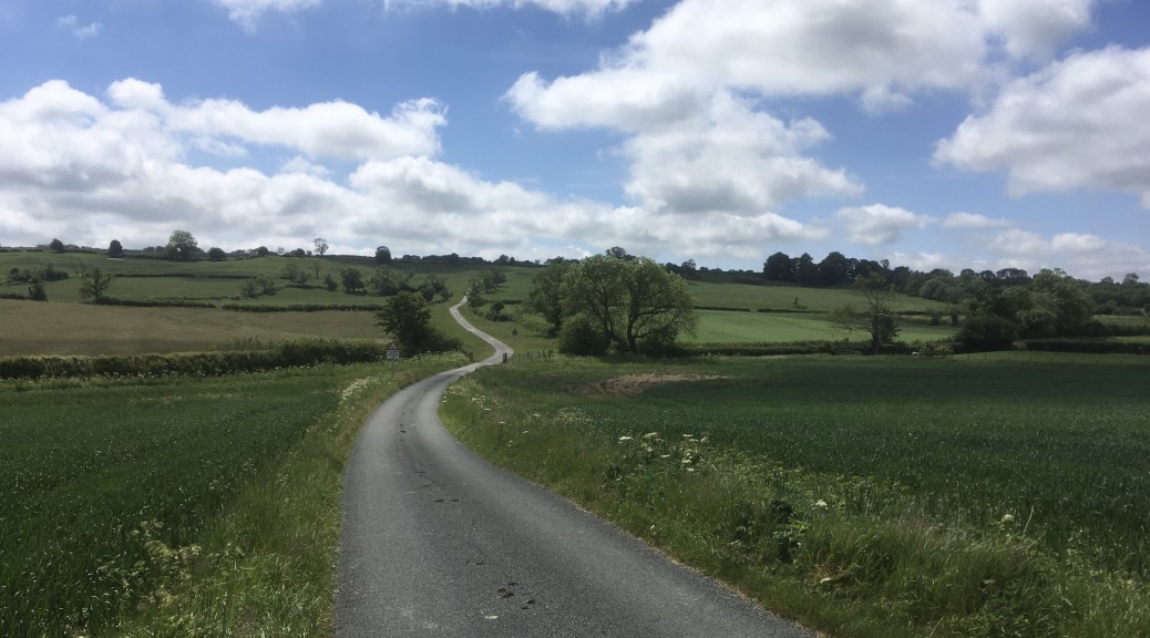
In 2010 a series of eight Big Skies Bike Rides was launched with the aim of encouraging cyclists to discover the varied and interesting terrain of the Yorkshire Wolds. ‘Western Wolds from Stamford Bridge’ is an at times challenging ride of around thirty miles from the historically significant village that straddles the River Derwent. This addition to the original eight Big Skies Bike Rides is unique among them in that the starting point is not passed through on the Yorkshire Wolds Cycle Route. Nevertheless, it does travel along Millington Dale and so overlaps with the Pocklington Big Skies Bike Ride.

I rode this ride eleven years ago to the day. The occasion was part of a local tourism body outdoors festival that has taken place in various forms over the years each September. I met Rupert Douglas, co-creator of the Yorkshire Wolds Cycle Route, Big Skies Bike Rides and Way of the Roses, to do this hilly loop from the free carpark in Stamford Bridge. This is an extract from a blog post I wrote back in 2013…

Continue reading Shorter loops: Stamford Bridge Big Skies Bike Ride

Hockney Trail: A Cyclist’s Route

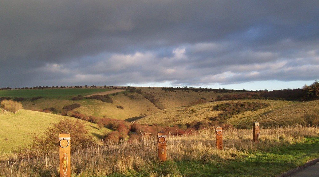
David Hockney’s association with the Yorkshire Wolds stretches back to the early 1950s when as a young man he spent two summers stooking corn on farmland in the area. In the late 1990s he returned to Yorkshire to be with his aging mother and to visit the ailing art gallery proprietor, Jonathan Silver. His childhood friend, it seems, encouraged Hockney to paint the East Yorkshire landscape and ‘The Road to York Through Sledmere‘, ‘The Road Across the Wolds‘ (both 1997) and ‘Garrowby Hill‘ (1998) were the result. After both his mother and friend died Hockney settled in the area, moving in to the home he had bought his mother in Bridlington. He began to sketch, paint and capture on iPad his favourite locations, revisiting them many times throughout the seasons; ‘Bigger Trees near Warter‘ needed to be completed during the winter before the sycamores came in to leaf and other places, most notably along Woldgate, were painted during ‘Action Week’ when covered in Hawthorn blossom.

Even before a well-received exhibition of ‘A Bigger Picture’ at the Royal Academy in 2012, Visit Hull & East Yorkshire tried to raise the profile of ‘Hockney Country’ and bring tourists in to this relatively overlooked part of the county. At some point those responsible for tourism in East Yorkshire and the Wolds, with the help of Rupert Douglas, set about creating eight (later nine) ‘Big Skies Bike Rides’, borrowing a phrase Hockney used to describe the skies over the American West. The Yorkshire Wolds Cycle Route includes a number of Hockney locations; however, despite most of those short, circular Big Skies Bike Rides covering the roads travelled by Hockney, there doesn’t seem to have been any attempt made to combine all of the locations chosen by the man himself and link them all together. This post aims to do just that. ‘Hockney Trail: A Cyclist’s Route’ is a little over 100 miles and (with the exception of the busy A166 at Garrowby Hill) takes in virtually all of the places studied by ‘Britain’s favourite living artist’.

In trying to avoid main roads as much as possible – and to limit going over the same ground – the route falls naturally in to two distinct parts. The eastern section goes out to the coast through Kilham via Thwing and then Rudston and the standing stone there before returning again through Kilham after the shallow climb of Woldgate. The western section sits entirely within the “candidate area” currently being assessed by Natural England for Area of Outstanding Natural Beauty status. (It seems fair to suggest that the epithet ‘Hockney Country’ has given some renewed impetus for this long overdue designation.) The western section is less spread out and is a loop taking in a number of Wolds favourites.

Continue reading Hockney Trail: A Cyclist’s Route

Cycling Climbs: Grimston Brow (Luddith Road)

My first recollection of this deceptively strength sapping climb was actually as a descent. I had ridden with a club to Malton and one of the newer members had wanted to complete his first 100-mile ride. So with a slight detour from the planned route we were able to incorporate the Thixendale Big Skies Bike Ride in to the day’s trip and tick both boxes. I typically approach this climb having passed through Settrington, heading south for a short stretch of the B1248 and popping over the little bridge with its unusually specific 25mph speed limit. Soon after there is a left hand bend and a junction on that corner. The signposted turnoff points to Birdsall, but we want the unsigned road along which a cottage and a utilities building can be glimpsed.

Beyond the buildings the road soon opens up a rather lovely view and a very satisfying sense of remoteness. Whenever I write about this hill I am at pains to point out that cows – and, we’re told, a bull – roam the open-gated fields between the cattle grids at the top and bottom of this climb. (The recent judicious use of a partly worn non-scratch scourer on the underside of my brake calipers is a reminder that the road is far from out of bounds for these roaming bovines.)

I’ve actually never turned around having seen loose cattle, but returning to that junction and following the signs to Birdsall – with the prospect of climbing Birdsall Brow – is a pleasant enough alternative, so it’s not the end of the world. One time on a solo descent, having passed the point of no return, I inadvertently triggered something of a stampede reminiscent of a scene from Jurassic Park, and was relieved to reach the sanctuary provided by rolling over the lower cattle grid. But I digress.

LuddithRoad_PaulRob
On a rainy ride from Sledmere with friends, in the days before the road was resurfaced

Continue reading Cycling Climbs: Grimston Brow (Luddith Road)

Shorter Loops: Thixendale Big Skies Bike Ride

In 2010 a series of eight Big Skies Bike Rides was launched with the aim of encouraging cyclists to discover the varied and interesting terrain of the Yorkshire Wolds. ‘Thixendale from Malton or Norton on Derwent’ is an at times challenging ride of just over twenty miles. It includes the stiff climb out of Birsdall; the wonderful Water Dale descent in to Thixendale; Burdale, with the short but punchy Fairy Dale climb up to Wharram Percy Wold; the reward of an enjoyable descent of Grimston Brow, and the final downhill stretch over Langton Wold as the route is retraced back to the start.

The only criticisms of this route – levelled by one of the group of cyclists who rode with me one day way back in 2012 – concerns the same road: the route over Langton Wold to and from Malton. It’s a fast descent but, unsurprisingly, a correspondingly slow ascent, which isn’t a problem with the other, quieter uphill stretches on this ride. It’s just that this can be a busy road and, for me at least, there is a greater sense of vulnerability as I puff and pant uphill with motor vehicles whizzing past. The other objection on the day was Langton Wold is effectively and ‘out-and-back’; a circular route is generally preferred by the majority of my ride buddies. Still, the same climb forms part of the Pock Pedal, following refreshments in a community centre or similar in Malton/Norton. Perhaps it’s an age thing.

Once over Langton Wold from the start in Malton there is a descent towards Birdsall and pretty views to be had through the estate of Birdsall House, one of an increasing number of Yorkshire country houses now offering its services as a film set.

Continue reading Shorter Loops: Thixendale Big Skies Bike Ride

Shorter Loops: Sledmere Big Skies Bike Ride

In 2010 a series of eight Big Skies Bike Rides was launched that were designed to encourage cyclists to discover the varied and interesting terrain of the Yorkshire Wolds. ‘Sledmere Country from Sledmere’ on the High Wolds is a ride that starts in East Yorkshire and passes over the border in to North Yorkshire. If you’re not already cycling through the village you can pull up in the car park near the memorials, grab your bike and set off down the hill. This is my favourite way out of Sledmere (at the Triton Inn turn left at the sign marked “Luttons Weaverthorpe”) and enjoy the rolling road towards the junction at a dip in the road between West Lutton and Cowlam.

Straight over the crossroads on towards Helperthorpe. This is a stretch of the Yorkshire Wolds Cycle Route, but once in Helperthorpe you’ll be looking out for a left turn signposted “E Heslerton Wold” – there’s also a brown Byways sign on the post – that will take you off the long distance route and on to a road with a heavily shrouded tree-lined summit. It’s almost a relief that you’re not on this road for long – the way ahead at first appears ominously steep – before turning left and passing Haverdale House along a very broken road surface that makes for a quiet route – unless you’re on bike that rattles. This road will find any lurking noise.

Sledmere_Big_Skies_Bike_Ride_Helperthorpe
The road out of Helperthorpe. If you have time there is a longer ride straight ahead, but on the Sledmere Big Skies Bike Ride it’s a left turn at the bottom of this hill

Continue reading Shorter Loops: Sledmere Big Skies Bike Ride

Shorter Loops: Pocklington Big Skies Bike Ride

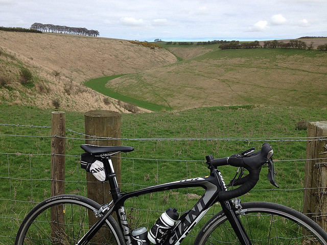
In 2010 a series of eight Big Skies Bike Rides was launched with the aim of encouraging cyclists to discover the varied and interesting terrain of the Yorkshire Wolds. ‘Millington Dale and Warter from Pocklington’ is a ride of less than twenty miles that includes the delightful Millington Dale; Huggate, with the highest pub on the Yorkshire Wolds; and an enjoyable descent in to Warter before the quiet and scenic Back Lane to Nunburnholme.

The B1246 east out of Pocklington is not the most pleasant way to start a bike ride, but the sightlines are good until the bend just before the turn off to Kilnwick Percy. (I’ll get this bit out of the way now: there is only one downside to this ride – but don’t let it put you off – as the road surface later between Burnby and Pocklington – at the time of writing – is not great.) [edit: the road surface between Burnby and Pocklington was resurfaced summer 2023] With the KP golf course to your left and the Kilnwick Percy Hall meditation centre to your right there is a steady incline before dropping down and then climbing gently to the pretty village of Millington. In normal times the Gait Inn and Ramblers’ Rest are recommended stops, and shared with the Western Wolds from Stamford Bridge Big Skies Bike Ride, a later addition to the series of rides, at this overlapping point.

Continue reading Shorter Loops: Pocklington Big Skies Bike Ride

Shorter loops: Market Weighton Big Skies Bike Ride

In 2010 a series of eight Big Skies Bike Rides was launched with the aim of encouraging cyclists to discover the varied and interesting terrain of the Yorkshire Wolds. The first time I rode “South Dalton, Lockington & Lund from Market Weighton” I had already been to Pocklington with ride buddies and stopped at Market Weighton to see the wooden statue to local legend William ‘Giant’ Bradley. (In the olden days when I would breezily cycle from Beverley to York along the length of the A1079 the road went through the centre of Market Weighton. Since then the town has been bypassed by the main road: Giant Bradley Way.)

On subsequent undertakings of this route I have parked in Goodmanham and ridden from there. Crossing the busy B1248 – twice – and having to spring open the Dalton Park gate at the Pipe and Glass means that the route is not exactly suited to being a time trial course, but when time is short – or fitness levels low – I have used the gently undulating road to test my fitness – or confirm the lack of it. But the main purpose of this and the other Big Skies Bike Rides is to explore the wonderful Yorkshire Wolds by bike – and for the Market Weighton ride there is something of a pub theme going on…

Continue reading Shorter loops: Market Weighton Big Skies Bike Ride

Shorter Loops: Sledmere and Thixendale from Pocklington

This wonderful 50-mile loop takes in elements of two Big Skies Bike Rides, but is different enough from both to be worth our consideration here. Heading out east from Pocklington you’re not on the B1246 long before taking the left turn at Kilnwick Percy. There follows six miles of glorious Yorkshire Wolds countryside through Millington Dale shared with the Way of the Roses and Yorkshire Wolds Cycle Route up to the outskirts of Huggate, before carrying on with the coast to coast route through Tibthorpe – described by Dixe Wills in the Guardian as his favourite road on the Way of the Roses – and as far as Kilburn (National Cycle Network Route 164).

Continue reading Shorter Loops: Sledmere and Thixendale from Pocklington

Cycling Climbs: Burdale

What’s the best moment so far from all the TV coverage of the Tour de Yorkshire? Thomas Voeckler gurning his way to victory along the Scarborough sea front? The cheering crowds on Sutton Bank as the riders winched their way up to the stunning edge-of-the-Moors viewpoint? Jadan-Weldtite/Vive le Velo-sponsored 17-year-old Georgi Pfeiffer claiming the queen of the mountains on the Côte de Baggaby Hill between Warter and Pocklington? Admittedly these are all excellent moments, but the answer, of course, is Brian Mussen cycling around Thixendale and Millington, and having a nice cuppa outside the Ramblers’ Rest in the Yorkshire Wolds. (I’m going all misty-eyed thinking about that video again.) Brian is the secretary of Scarborough Paragon Cycling Club, based in the seaside resort that borders on to the North York Moors. But when location shooting took place to promote the 2017 edition of the Tour de Yorkshire it was to the empty lanes and quietly testing climbs of the Yorkshire Wolds that Brian and the camera crew headed.

Burdale - Yorkshire Wolds Cycle Hill Climbs having a rest

Continue reading Cycling Climbs: Burdale

Shorter Loops: Beverley Big Skies Bike Ride (With a Twist)

In 2010 a series of eight Big Skies Bike Rides was launched that were designed to encourage cyclists to discover the varied and interesting terrain of the Yorkshire Wolds. ‘North Newbald and back from Beverley’ was the first that I rode. Since then the East Riding of Yorkshire Council developed and expanded upon rides from Beverley, Pocklington and Bridlington amongst others. One of the ERoYC rides from Beverley closely follows the route of the Big Skies Bike Ride – only in reverse. Instead of doing the route clockwise, the notes accompanying the newer variant suggests it should be ridden anti- clockwise “for safety reasons” – it tackles Trundlegate uphill rather than as a descent.

Writing in Cycling Active, Maria David rode a variation of the original route that avoided backtracking on Middlehow Road to Walkington instead returning to Beverley along Walkington Heads to make a loop of it.

So, that’s three versions of a ride from Beverley to North Newbald and back. Here’s a fourth – with a twist…

Continue reading Shorter Loops: Beverley Big Skies Bike Ride (With a Twist)