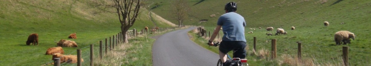

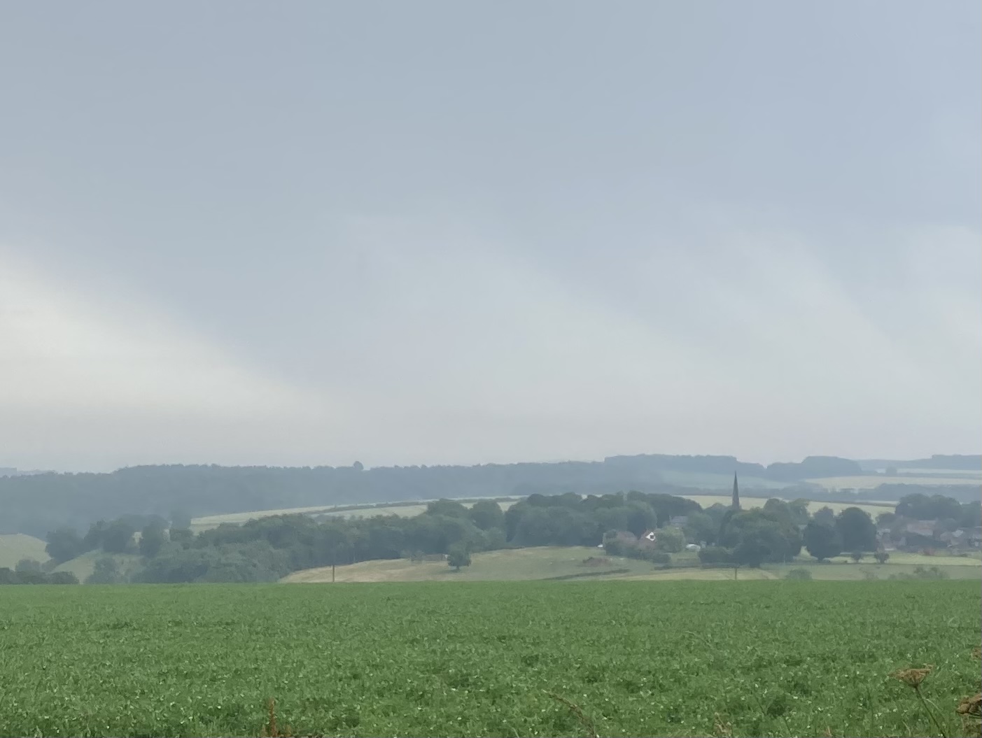
David Hockney’s association with the Yorkshire Wolds stretches back to the early 1950s when as a young man he spent two summers stooking corn on farmland in the area. In the late 1990s he returned to Yorkshire to be with his aging mother and to visit the ailing art gallery proprietor, Jonathan Silver. His childhood friend, it seems, encouraged Hockney to paint the East Yorkshire landscape and ‘The Road to York Through Sledmere‘, ‘The Road Across the Wolds‘ (both 1997) and ‘Garrowby Hill‘ (1998) were the result. After both his mother and friend died Hockney settled in the area, moving in to the home he had bought his mother in Bridlington. He began to sketch, paint and capture on iPad his favourite locations, revisiting them many times throughout the seasons; ‘Bigger Trees near Warter‘ needed to be completed during the winter before the sycamores came in to leaf and other places, most notably along Woldgate, were painted during ‘Action Week’ when covered in Hawthorn blossom.
Even before a well-received exhibition of ‘A Bigger Picture’ at the Royal Academy in 2012, Visit Hull & East Yorkshire tried to raise the profile of ‘Hockney Country’ and bring tourists in to this relatively overlooked part of the county. At some point those responsible for tourism in East Yorkshire and the Wolds, with the help of Rupert Douglas, set about creating eight (later nine) ‘Big Skies Bike Rides’, borrowing a phrase Hockney used to describe the skies over the American West. The Yorkshire Wolds Cycle Route includes a number of Hockney locations; however, despite most of those short, circular Big Skies Bike Rides covering the roads travelled by Hockney, there doesn’t seem to have been any attempt made to combine all of the locations chosen by the man himself and link them all together. This post aims to do just that. ‘Hockney Trail: A Cyclist’s Route’ is a little over 100 miles and (with the exception of the busy A166 at Garrowby Hill) takes in all known places studied by ‘Britain’s favourite living artist’.
In trying to avoid main roads as much as possible – and to limit going over the same ground – the route falls naturally in to two distinct parts. The eastern section goes out to the coast through Kilham via Thwing and then Rudston and the standing stone there before returning again through Kilham after the shallow climb of Woldgate. The western section sits entirely within the “candidate area” currently being assessed by Natural England for Area of Outstanding Natural Beauty status. (It seems fair to suggest that the epithet ‘Hockney Country’ has given some renewed impetus for this long overdue designation.) The western section is less spread out and is a loop taking in a number of Wolds favourites.

Take a minor detour to visit Britain’s tallest megalith. It would be rood not to…
Hockney Trail: A Cyclist’s Route – overview
You can view both the Garmin Activity and Strava segment for this Hockney Trail: A Cyclist’s Route. (Edit August 2024: these links updated to include the climb up to Cowlam in order to view ‘A Road Across the Wolds‘.) I am indebted to Simon Gregson for his detailed analysis of the Hockney locations. Although all images here are my own – you will note that I dutifully observe Hockney’s assertion that “you can’t photograph the landscapes here” – I reproduce in limited form some of the information Simon gathered, specifically the grid references first published on www.yocc.co.uk, since delisted.

Hockney Trail: A Cyclist’s Route outline in Garmin Connect
In the version of the route detailed here we start at Huggate, one of the highest villages on the Wolds, although I first rode the full course from nearby Field House campsite, an excellent base for Yorkshire Wolds day rides. (Alternative places to begin the ride might include Sledmere, Weaverthorpe – or even Bempton if choosing to arrive by train.) From Huggate the route drops to Wetwang then climbs to Sledmere along Life Hill.
(St Andrew’s, Kirby Grindalythe on the Sykes Churches Trail is notable for its mosaic by the Venice and Murano Glass & Mosaic Co. depicting the Ascension. At barely a dozen miles in to the ride it is perhaps too soon to make a stop, but its west wall is a rather impressive affair.)
From Kirby Grindalythe we travel along the ‘Great Wold Valley’ and pick up the Yorkshire Wolds Cycle Route as far as the outskirts of Foxholes before taking the road to Thwing. Our first visit to Kilham is preceded by our first Hockney locations – not pictured – ‘The Road to Thwing, Late Spring‘ (Grid: TA 05801 66398), albeit viewed over the shoulder, along with ‘Harvesting Near the Road to Thwing‘ are followed by ‘Hawthorn Blossom near Rudston‘ (not listed on yocc.co.uk).

‘Hawthorn Blossom near Rudston‘. Er, probably
‘Track and Hedgerow‘ (Grid: TA 08862 66665) just before Rudston and painted in January 2006 featured in the last of the 80 outtakes from Bruce Wollheim from his 2010 documentary.
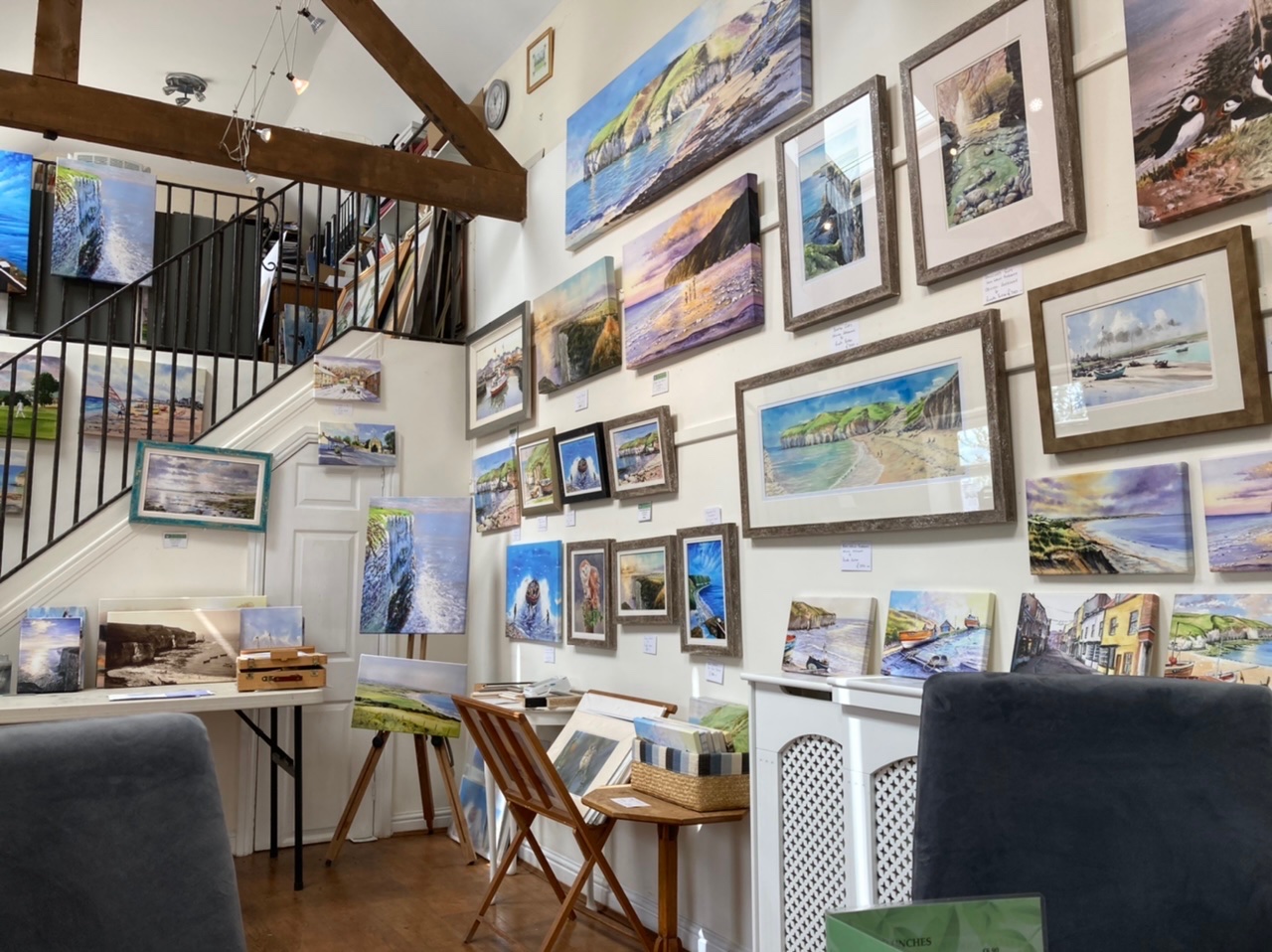
Moving on from there towards Grindale via Rudston – with a short, lumpy stretch of occasionally busy road – gets us back on the YWCR and Buckton, Bempton, Sewerby and Bridlington. There are galleries in Bridlington as well as plenty of places to eat, but my recommendation would be The Gallery Tea Rooms in Buckton which, rather neatly, doubles as a gallery for watercolour artist Richard Burton.
All the way from Grindale the trail deliberately follows the Yorkshire Wolds Cycle Route to deliver us to Woldgate and the concentration of places Hockney chose to study in oil and iPad.
There are numerous Woldgate locations detailed by Simon Gregson on www.yocc.co.uk, most of which I haven’t photographed, but which can be viewed from the laybys that pepper this Roman road. The exception would appear to be ‘Walnut Trees‘ (Grid: TA 13622 67512.) Simon suggests a stop at ‘Woldgate Woods‘ (Grid: TA 13723 67017) and that by “parking your car there, you can [...] go down the hill following a track to Boynton. It is down this track that ‘Walnut Trees’ was painted.”
The Woldgate locations between Bessingby Hill (Bridlington) and Kilham
In following the Yorkshire Wolds Cycle Route (and the Way of the Roses) from the Bridlington coast the trail makes its way to Woldgate. It avoids a Hockney location at this point, but for those wishing to scrupulously observe each point of interest – albeit this particular one filmed rather than painted – a detour from the Garmin/Strava route is not far: ‘25 Trees between Bridlington School and Morrison’s supermarket along Bessingby Road in the Semi-Egyptian style‘ (Grid: TA 17217 66786). See the Bessingby Road page from Visit East Yorkshire’s web site for a minor detour if you wish. Best viewed from the entrance to the fire station, apparently.
Back on to Woldgate and the places of interest come thick and fast. What follows is a list of locations you may wish to keep an eye out for…
‘Woldgate Tree‘ (Grid: TA 15630 67353) and nearby ‘Lovely Day with Puddles‘, ‘Woldgate Winter Tree, 2006‘ and ‘Road and Two Trees East Yorkshire‘.

‘The Arrival of Spring‘ (Grid: TA 14520 67316)
‘Woldgate Woods‘ (Grid: TA 13723 67019) and from there the track towards Boynton and ‘Walnut Trees‘ (Grid: TA 13622 67512) as detailed earlier – ‘Walnut Trees‘ is not on the Garmin/Strava route for this ride.
‘Winter Timber‘ (Grid: TA 13206 66872), and a totem since cut down by vandals. Just beyond this a right turn heads towards Boynton. Apparently, at the edge of the woods down the hill the painting ‘Roads and Cornfields‘ was created, as well as the watercolour ‘After Rain‘.
‘Early Blossom Woldgate‘ (Grid: TA 12011 66380) before a hedgerow in the left and a small lane across the fields. The painting was made looking towards Kilham.
Woldgate leads directly to Kilham where ‘Midsummer‘, and the puddle and tunnel locations follow in quick succession.
‘Midsummer‘ (Grid: TA 06516 64423) the view of the church from East Street is one from the ‘Midsummer’ series.
 ‘Late Spring Tunnel’, Kilham (Grid: TA 04814 64760)
After the tunnel continue on the road to Langtoft (just before the village ‘Tracks into a Wheatfield near Langtoft‘ is on the right beyond a gated entrance).

‘Tracks into a Wheatfield near Langtoft‘ (Grid: TA 01433 66160)
Once in the village take the second exit north on the mini-roundabout and a short uphill stretch of the B1249 before picking up the minor road left along the road towards Sledmere. (Note also that St Peter’s, Langtoft is a significant church sadly omitted from the Sykes Churches Trail: A Cyclist’s route. Follow the brown tourist signs for a short diversion if you would like to tick this one off.) This ultimately brings us back to the Great Wold Valley near Helperthorpe, where the Yorkshire Wolds Cycle Route is picked up again briefly before a turning left at the crossroads at the bottom of the hill to head up to Cowlam and go along ‘The Road Across the Wolds‘.
Collingwood House from ‘The Road Across the Wolds’
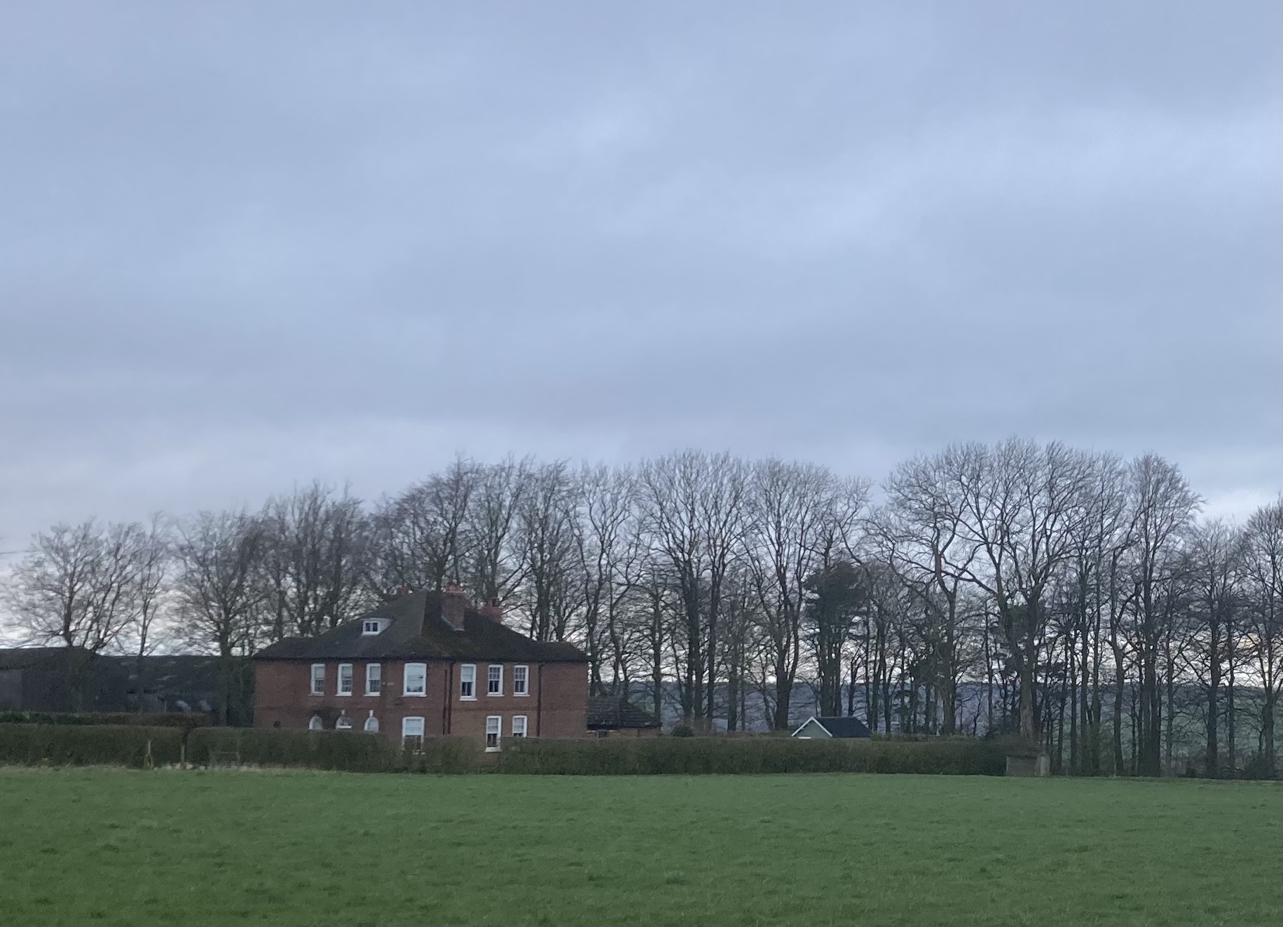
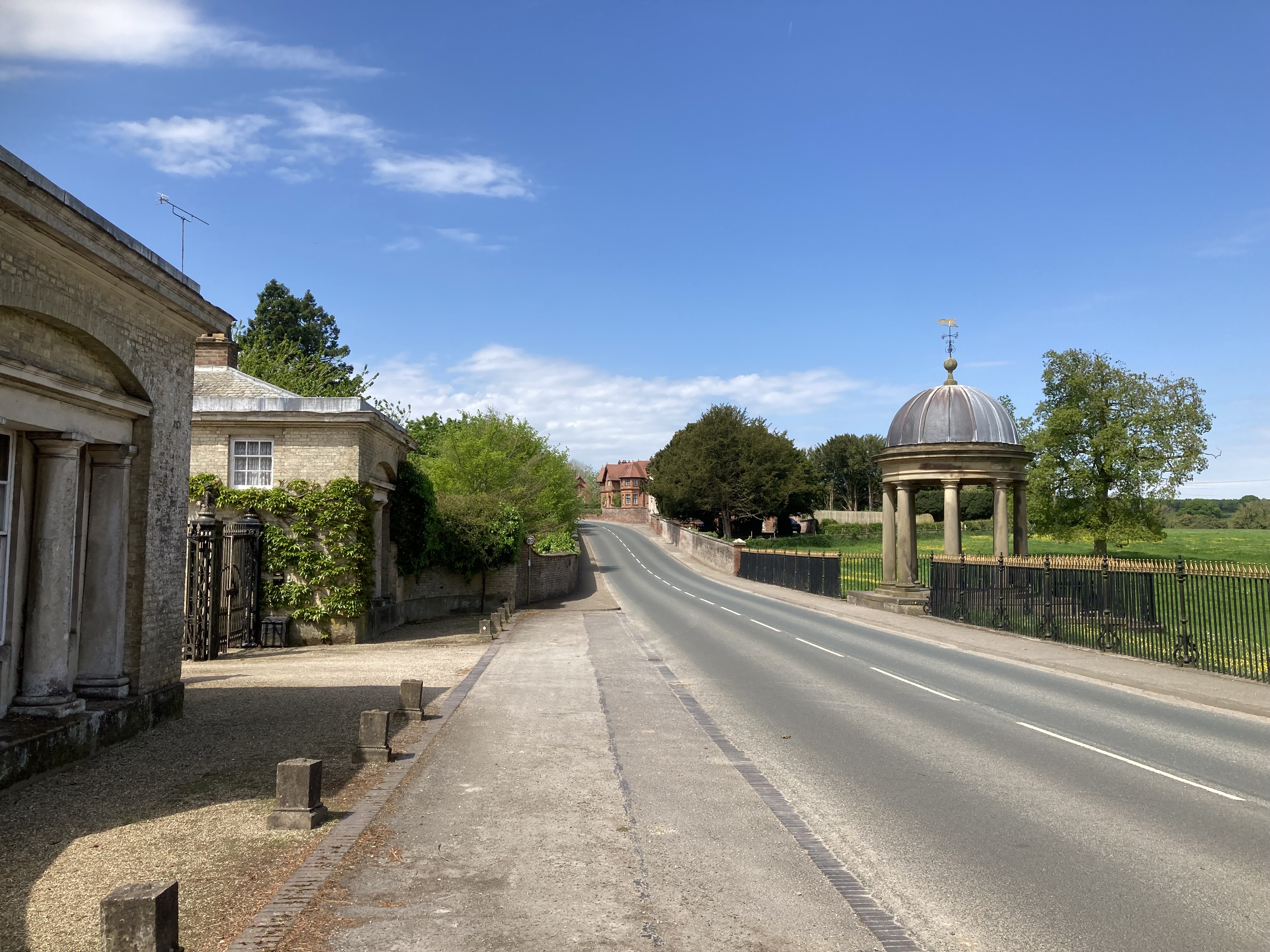
(At the top of the climb to the Cowlam crossroads we head down to Sledmere passing Collingwood House which features in that oil on canvas painting. The B1253 can be busy, but even this risk averse cyclist isn’t fazed by the mostly downhill stretch in to Sledmere. Just don’t ride it uphill would be my advice.)
The rotunda seen in ‘The Road to York Through Sledmere‘
A word of caution. The mostly downhill stretch of the B1251 from Sledmere heading west has caused me no upset, but it’s arguably not for the squeamish. (It can be busy, but I can always get a move on; I wouldn’t choose to ride in the opposite direction uphill, though.) The Big G Sportive takes this road as far as the roundabout near the picnic area and Yorkshire Wolds Railway sidings – before heading north along the B1248 – but we go straight over the roundabout and continue along the B1251 on the way to the village of Fimber, carefully taking the right turn to Burdale. We’re heading to Thixendale now along the narrow valley road that has become rather busy in recent times. There is just enough room on the far side of the road to pull over in to the scrape of a layby-cum-passing place and view ‘Three Trees near Thixendale‘.
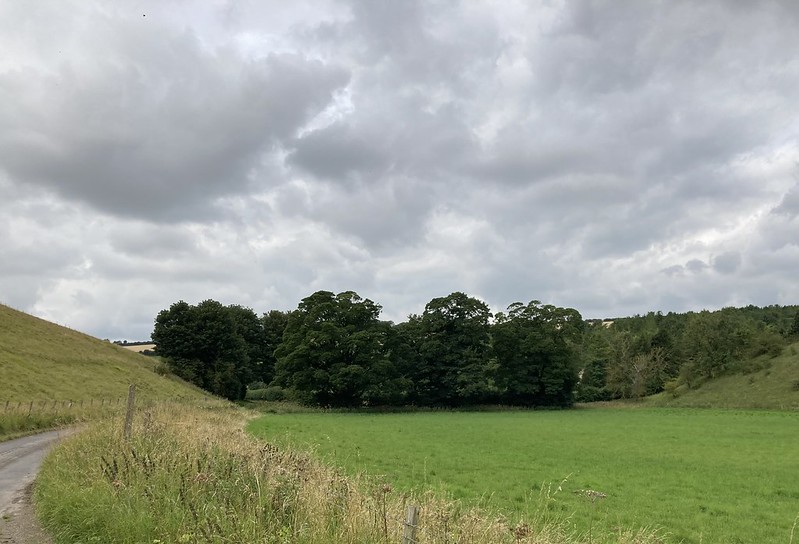 ‘Three Trees near Thixendale‘ (Grid: SE 86822 62287)
In Thixendale (Cross Keys pub, village hall refreshments Sundays only) take the steep road immediately beside the village hall and head up towards the Roman road. Once over, take particular care on the steep descent through Uncleby Wold, follow the road around and take a left to pass through Kirby Underdale and drop again before the climb of Painsthorpe Lane.
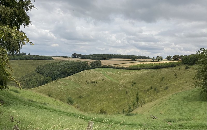 ‘Bugthorpe Valley’(Grid: SE 82216 58275) or Painsthorpe Dale near the top of the road out of Kirby Underdale
At the Roman road again, take a left and then a right along the ‘Fuller Gallery Road’. Regular viewers of the BBC’s The One Show will be familiar with Robert Fuller’s wildlife videos that allow us to share moments from the lives, loves – and occasionally deaths – of stoats, kestrels and owls etc. The gallery is an impressive setup.

Fuller Gallery, Fotherdale, Yorkshire Wolds
At the bottom of the gallery’s road take the sharp right uphill towards Huggate. The trailer for Bruno Wollheim’s ‘David Hockney: A Bigger Picture’ documentary shows the artist and his assistant struggling with the wind as they wrestle with an easel and the quickly changing light.

The painting shown in this Huggate Road scene from the trailer is not specifically referred to as ‘A Bigger Picture’ exhibited work – perhaps it was never completed – but the view is over to Fotherdale and the Fuller Gallery
(As we near the layby on the left of Huggate Road we see where Hockney pulled over to set up on the opposite side of the single track road. Further along is where ‘Wheat Field near Fridaythorpe‘ (Grid SE 84462 60096) was painted. It featured on the August 2020 cover of British Vogue.)
Over the A166 – a very busy road – I don’t go as far as Huggate just yet, instead picking up the clockwise Yorkshire Wolds Cycle Route in the direction of ‘Garrowby Hill‘. However, rather than revisiting that main road at the staggered crossing of the A166 – detour if you must be faithful to all of the Hockney locations – I stay on the road, bearing left, and drop down the hill in the direction of Givendale. Watch out for a tight left turn towards Millington that you’ll need to take, though.
On this route I don’t go in to the village itself, but the attractions there include the Gait Inn, Ramblers’ Rest tearoom and a repurposed phone box converted to provide spares and tools for passing cyclists.
Millington Dale is a beautiful and rewarding valley to pass through on any cycle ride. It brings us towards Huggate.
 ‘Wider Valley, Millington‘ (Grid: SE 84790 53949) on both the Yorkshire Wolds Cycle Route and Way of the Roses
NB The Garmin/Strava routes don’t show a diversion immediately before Huggate, but those wishing to visit the location for ‘Huggate’s St Mary’s Church Spire‘ can follow the blue cycle route signs pointing in the direction of the Yorkshire Wolds Cycle Route. After a few hundred metres look for a layby on the opposite side of the road from which the church can be seen.
If you have taken the short out-and-back to view St Mary’s Church spire, Hugggate from the York Road, return to enter the village then take the right turn before the Wolds Inn and continue on to Warter. A right turn at the B1246 T junction and a left turn opposite the village pond will take you to Bailey Dale and the climb of Bailey Lane to ‘Warter Vista‘ (Grid: SE 87765 49310), which can’t really be viewed without stopping at the roadside and taking a look back down the dale.
At the end of this road there is an unremarkable clump of trees over on the right. They were planted to replace those chopped down before Hockney could finish painting them for the third and fourth seasons – ‘Bigger Trees Nearer Warter, 2008‘ (Grid: SE 88432 48763) – see this Hockney Foundation video (not to be confused with the final location on this tour). Instead, we have ‘Less Trees near Warter‘, which would appear to have been created not long after the trees were felled.
The last painting on this Hockney Trail was one I found particularly difficult to photograph for inclusion here. I actually went to see ‘Bigger Trees near Warter‘ (Grid: SE 89487 50188) at Ferens Art Gallery, Hull some years ago. The fifty panels were curved at the sides. Was it to suggest the way that nature envelops us as we are inexorably drawn in to it? Or something. No, there simply wasn’t enough space to display the full installation, and so they had to curl the edges round to fit it all in the room. Similarly, I couldn’t get far enough back to photograph the full view of it in the flesh, as Hockney himself admits:
Bruno Wollheim: “The view you’ve got must be way back there.”
David Hockney: “Yes, it is, yeah. Well, in your head you can go anywhere. Didn’t you know that?”
Watch one of the 80 outtakes released on Hockney’s 80th birthday: Outtake 5/80 ‘Sketching Bigger Trees Near Warter, 19th April 2006′ by Bruno Wollheim on YouTube for a view on site.
The ‘Bigger Trees Near Warter’ at spring time
So, all that remains is an enjoyable, long shallow descent to Middleton on the Wolds then the drag out of North Dalton back in the direction of Huggate before returning to the start point of this Hockney Trail: A Cyclist’s Route.
Actually, the final word for now should probably go to the man himself. Enjoy the ride. Enjoy the space…
I worked on a farm. I cycled around here for two summers… You get to know it’s hilly if you’re cycling. I was always attracted to it. I always thought it had space. One of the thrills of landscape is that it’s a spatial experience.
Note: this page was amended August 2024 to include the Cowlam climb in order to pass through the scenery depicted in ‘The Road Across the Wolds‘.
Chris,
Many thanks for devising and describing this route, which I’ve stumbled across by chance TBH, whilst looking for rides out of Beverley.
I actually met David Hockney in Normandy last summer (’23), quite by chance, when on a cycling tour. I’ve been an admirer of his work for many years so you can imagine what a slightly overwhelming encounter it was!
I’m very tempted to give your route a go later in the year when the weather’s more benign and days are longer, probably basing myself in Beverley again, where I’ve found a great, cyclist friendly AirBnB.
Thanks again for the hard work you’ve put in here – I’m flabbergasted that it is not better known and commented upon either here or on Strava.
Hi, Robert.
Thanks for taking the time to leave your kind comments. Although I might give a minor tweak to the route – to include ‘Road across the Wolds’ near Cowlam – I hope I’ve put together a varied, interesting and as safe as possible route for cyclists to enjoy based on the constraints of the Hockney locations.
If you are able to get out and complete some or all of the route please get back to me with any feedback – I hope you are able to enjoy the trail during nicer weather.
I often wonder what I would have said to Hockney had I seen him around the Wolds – nothing, probably!
Sorry for not approving your comment sooner – I have to wade through a considerable amount of spam comments before winkling out the genuine ones
I did very nearly all of this ride with some friends in early May. Thoroughly enjoyed it, excellent views, some challenging hills and great cafes along the way. Plus the Hockney points of interest.
Indeed. Glad you enjoyed the ride, Rob. Sorry I didn’t quite have the legs to get around – and slowed you down – on the day. We’ll be back!
it would be really useful if gradient maps were provided with the routes for beginners and older folk without e-bikes
Hi, Sandy. If you click on the Strava or Garmin Connect links you can see the headline figures for elevation etc and view the profile of the ride. The Garmin link – immediately below the “overview” subheading – in particular allows you to check out the gradients dynamically, say, in case you wanted to base yourself in Sledmere – an obvious place to stay for anyone wanting to do the ride over two days. For instance, if you move the vertical line to Sledmere on the map you can see that the longer section – out east to the coast and back – is around 100km, but flatter compared to the rest of the route. That western section – over the lumpier Wolds proper – is only 60km but contains the majority of the climbing. I hope this helps.