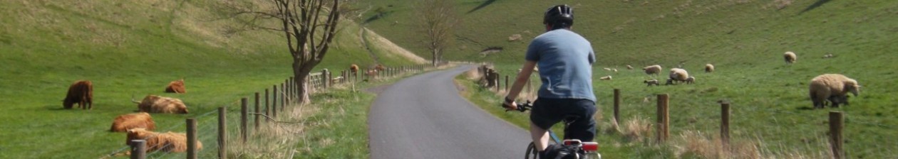

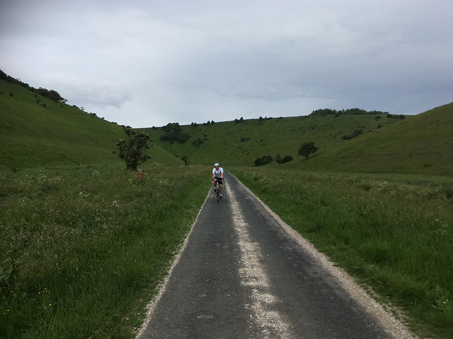
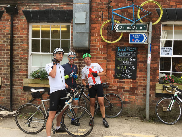
The Yorkshire Wolds Cycle Route is a scenic, 146 mile tour of the East Riding and North Yorkshire, taking in the coast along the way. It was opened in 2011 and I rode the then proposed route with ride buddy Steve one day in April of that year. Seven years on, and with a few revisions to the official route, I once again set off from Beverley Minster in a clockwise direction just after 6.00am with one other rider – this time Paul.
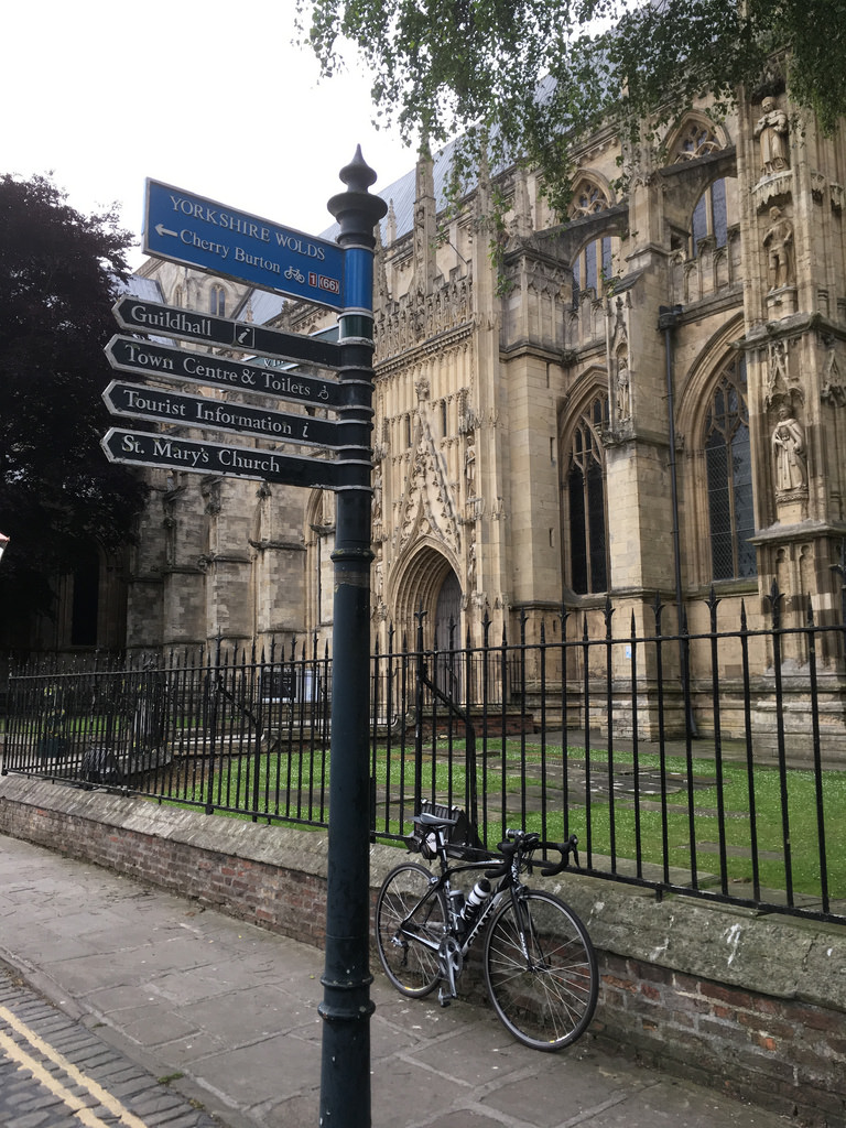
The spiritual start of the Yorkshire Wolds Cycle Route: Beverley Minster
I knew we would be deviating slightly from the prescribed course, north of Newbald, because on Stoneknowle Hill riders are pointed in the direction of a stretch of lumpy bridleway (more on that later). I wanted to otherwise follow the route as faithfully as possible, so naturally I strayed off the official course within about twenty yards of starting. It would appear that the short stretch of road running perpendicular to where we had started from – just outside the minster – was the same road I’d already travelled that morning. I thought it was further on when I plotted the route online and couldn’t make out the fuzzy yellow highlighting on the official map. Ahem. Maybe next time…
Beverley to Huggate
There is a cycle path from Beverley Westwood to and through part of Walkington, but at such an early hour on a Saturday we took the highway and were soon on the quiet Littlewood Road that gradually makes its way to the highest point of the southern Yorkshire Wolds, before dropping sharply in to South Newbald along Trundlegate and its exhilarating descent.
Past the two pubs in North Newbald and on to Stoneknowle Hill. This is only a short, not very steep little loosener of a climb, but already I realised I would not find climbing on this day to be as comfortable as Paul would.
Now then. Both the proposed and finalised routes point to a left turn whilst on this road. It would have taken us on to the Yorkshire Wolds Way long distance walking route between Hessle and Filey. Back in 2011 the provisional map stated that this part of the YWCR was “to be upgraded”. I’m not sure whether that meant in status from footpath to bridleway, or that the surface was to be improved, but the last time I travelled that way over the rutted mud and chalkstone it took me an age and I had to walk much of it.
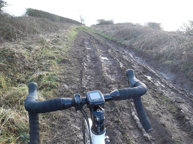
The Yorkshire Wolds Way bridleway. Not always easily passable (photograph taken earlier in 2018)
So our first – okay, second – diversion from the route was at Gardham and Etton after crossing the A1079. A word of caution. For three years I organised a series of challenge rides that went over the A1079 here. For this crossing point I borrowed ‘Cycle Event’ signs and placed them either side of the junction. I understand that there has been at least one fatal collision here – the sight lines towards Market Weighton are made trickier by a dip in the road – and we gave way to a lorry and procession of cars before slipping over this staggered crossroads. Something to think about.
More fun descending in to Gardham, skirting Etton and towards the glorious sight of St Mary’s church in South Dalton – you may have seen images from the Tour de Yorkshire of riders jockeying up the short ramp outside Etton with the remarkable spire visible above the treeline in front of them.
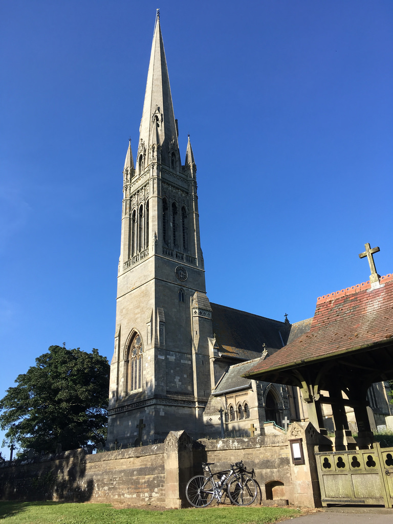
St Mary’s Church South Dalton (photograph taken on a different ride in June 2018)
We were now in the lovely Kiplingcotes valley, scattering rabbits, spotting Yellowhammers and wondering whether the long-eared animals grazing in the field to our right were sheep or calves. It was still early, remember.
If I were to do this ride as a multi-day tour I might be tempted to give Market Weighton a swerve and pop in to the former pop-up café in nearby Goodmanham. The now firmly established Fiddle Drill offers excellent food and drink for those on a leisurely ride through these parts. As it happens I had only a tenner on me, so I used a cashpoint in the town long bypassed by the A1079. To be fair, I gather a few cafés have now opened up in Market Weighton.
On towards Londesborough – watch out for deer – and Burnby along a rather broken road surface to Pocklington. This Wolds edge town is an excellent base for day rides (see the Pocklington Cycle Map).
It had started to rain at Londesborough, but by Kilnwick Percy we were taking off our jackets and welcoming the cool air as we passed through the truly beautiful Millington Dale, described in Cycling Plus as a ‘hidden gem – an intimate valley-floor shimmy through luscious micro-Alps’.
No time for setting up for a photo today, just a glimpse over the shoulder with my iPhone as we enjoy the views in Millington Pastures
After the testing little ramp at the end of Millington Dale I was ready to freewheel in to Huggate and meet Jason and Rob, the latter with his promised supply of bananas and bottled water.
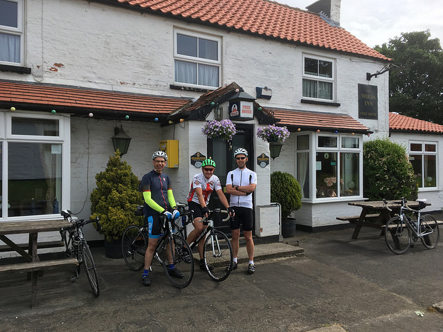
A quick chat outside the Wolds Inn, Huggate – supposedly the Yorkshire Wolds’ highest – too early to enjoy ‘the best pub chips in Yorkshire’ – Guardian
Huggate to Sledmere
I can’t be absolutely certain that a later junction was properly signed as we made our way to Garrowby Hill – the highest point on the Yorkshire Wolds – via a distinctly indirect meander. Once across the A166 – take especial care crossing here – we weren’t on roman road for long before taking the “Fuller Gallery” road in to Thixendale. This is a much more enjoyable descent since being resurfaced quite recently. Back in 2011 it was sketchy in parts.
Thixendale is a picture postcard village, well served by roads that radiate from this fairly isolated part of the Wolds; I believe it was one of the last places in Yorkshire to be able to receive television. (There is a shop in the former post office and on Sundays the Village Hall – a former Youth Hostel – opens for refreshments.)
If you’ve seen photographs of riders on the Yorkshire Wolds chances are they will have been riding up or down Water Dale at Thixendale. Apart from Brian, of course, the star of this trailer from the 2017 Tour de Yorkshire was the network of roads around Thixendale, as well as Millington Dale. Water Dale can be enjoyed in equal measure in either direction (some hills in these parts are too short and steep to fully enjoy going downhill). Again I struggled to keep up with the others as they distanced me whilst chatting away. Still, the wonderful scenery provided a distraction from my discomfort.
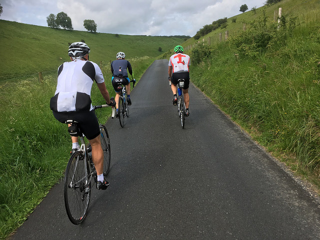
Water Dale out of Thixendale. Just about every sportive in the Yorkshire Wolds goes along this road
Over the next crossroads and a vision loomed that I have never been able to do justice to – the view over to Malton and the North York Moors. Don’t focus too much on the scenery, however, as there is a hair-raising descent to come. Paul said he had to make a phone call home. We gave him a funny look and dropped in to Leavening. This downhill stretch is steep, twisting and at times gravel is washed from the banked roadside on to the tarmac below. (I heard a story of a one poor soul who hit the house at the bottom of the hill and had to be taken away by ambulance.)
A right turn at the edge of the village towards Burythorpe. I caught the briefest of glances of the striking church I first saw riding the Western Wolds from Stamford Bridge Big Skies Bike Ride and then through delightful narrow tree-lined lanes new to me on to Westow, and then Kirkham. A sharp right, uphill turn took us towards Menenthorpe and the charming Lzysike Wood (glimpsing between trees the River Derwent over to our left). We followed the route through Norton missing out Malton altogether – I recommend the Yorkshire Tea Rooms if you do need refreshments in Malton – and headed east along the B1248 where we saw dayglow-clad marshals at the turn to Settrington.
(At Settrington a combination of my muddled thought processes, inaccurately plotted route and age-related dithering meant that we didn’t follow the prescribed route further in to the village. We should have taken the road bridge and soon after crossed back over the river via a footbridge or – had we been brave enough – the little ford.)
Settrington Bank appears as a listing by local CTC legend Roger England in his excellent “Hill Climbs of the Yorkshire Wolds”. On this day – and apparently every third Saturday after the Spring Bank Holiday – the Great Yorkshire Bike Ride takes in this cheeky climb on the way to the coast. Two or three cyclists with numbers ziptied to their handlebars overtook us – I would later console myself with the thought that they might have been overnighting in Filey and so on a shorter ride to our own. Thankfully, Jason dropped back for me on this lovely – if testing – climb and although I did not stop I did suffer the indignity of my Garmin auto-pausing as I made “steady” progress uphill. I smiled for the photographer stationed beyond the top of the bank as his rather professional looking set up popped a flash as we passed.
On the Yorkshire Wolds Cycle Route riders are steered away from the full, magnificent descent of this breathtaking ridge that leads to West Lutton, instead there is a right turn to Duggleby in order to set up the descent to Sledmere, cut off the corner of a slightly busy road, and to view Duggleby Howe, which is important for being one the largest round barrows in Britain.
Next up Kirkby Grindalythe and, before Sledmere, a little dink – there’s a single chevron on the OS map – to finish off the legs before refreshments at the Coach House Café. The café is in the open area within the grounds of Sledmere House – you don’t need to pay for admission to use it – and is an ideal and welcome staging post between Huggate and Bridlington. Beans on toast, soup of the day, cake, tea & coffee and we were away again, although we stopped for longer than planned at more than half an hour.
Sledmere to Bridlington
With a favourable tailwind urging us on and Jason as our lead out man we quickly reached Foxholes – having passed quite a few GYBR entrants sitting outside a number of enticing village pubs along the way. Just before Foxholes the Yorkshire Wolds sign had us cross the B1249, turn left, take another left turn then ride parallel to the main road, before meeting it perhaps a couple of hundred yards further on. I’m not sure it was worth the effort of trying to get back on track; it took us a while to find a gap in the traffic so that we could turn right at a ‘T’ junction. In hindsight I could see that it would make sense if riding in the opposite direction, and perhaps the sight lines aren’t great – and the speed limit still high – for traffic heading north in to Foxholes.
Anyway, turning left off the ‘B’ road we eventually headed north and I again struggled to keep up with the others as the sun made an appearance and the already long day started to take its toll when the road went steadily upwards. Rob dropped back to give me his wheel on this road heading towards Ganton and, fortunately, Jason and Paul didn’t hear my call so missed our right turn; I was able to catch up and feel the breeze at my back on the descent to Fordon. The Great Wolds Valley – home to Wold Top Brewery – is a very pleasant diversion before the brief, uphill stretches of the sometimes busy road on to Hunmanby.
Here we were distracted by the signs partially hidden in undergrowth, took a left turn and followed the GYBR cyclists. It turned out we were meant to carry on at the crossroads as this would have taken us by the shops and pubs in the village. Instead we emerged at a roundabout where more marshals shepherded us by chance in the direction of our blue ‘Yorkshire Wolds’ signs as we picked up the trail again.
Outside Hunmanby the route heads towards Reighton. Those signs took us away from a roundabout and we crossed the A165 further north where a motorcyclist heading south stopped the cars behind him for us or we would have had a longer wait to find a gap in the traffic. Speaking of gaps…
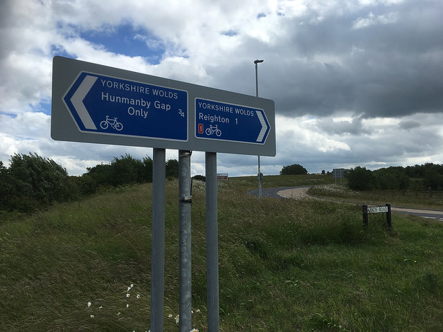
Mind the Gap. Hunmanby Gap is by all accounts a pleasant diversion. Just not today
… Jason followed the tracks off the roundabout and had to be called back when my Garmin eTrex highlighted that we were heading away from its breadcrumb trail. He had – it seems – followed the signs to Hunmanby Gap – an extra diversion similar to the one to Bempton Cliffs – that we needn’t follow on the day. (Francis’s group were caught out in the same way on their ride.)
Initially, I didn’t particularly care for the next bit to Reighton. It was nice to spot the cliffs over to our left but, as we turned south in to a headwind, I didn’t enjoy being on a road with double solid lines painted down the middle. However, we weren’t on the road long and, after a crossroads, found ourselves on a quiet single track as we moved towards Grindale, Buckton and Bempton.
This part of the Yorkshire Wolds is considerably different from the areas to the south and west. Here, in the northeast of the region, long stretches of roads are far from featureless, but the scenery is not as obviously striking as, say, Millington Dale or Thixendale. A characteristic shared for the most part, however, is their sheer tranquillity, which combined with the utter lushness of the place makes for such thoroughly enjoyable cycling. Apart from having to cross the occasional main road there is generally little motorised traffic to spoil the ride and we were able to cycle two abreast pretty much as often as we wanted.
At Sewerby I had intended to stop at the pub for a while, but the others didn’t want to hang about so I downed half a lemonade and a handful of nuts.
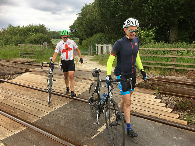
The lads show their heartfelt sympathy as Paul makes another phone call home
Bridlington to Beverley
The helpful staff did, however, fill our water bottles before we rode along the cliff tops in to Bridlington. Time was pressing, so no photographs at the headland and on through the (wrong again) streets to the A614 cycle path and Woldgate. Going up this picturesque, gradually rising road – made famous by David Hockney’s exhibition a few years ago – was a prospect I was ever so slightly dreading. I was certain that by this point I would struggle getting up Woldgate – we flew down in the opposite direction on the Way of the Roses ride two summers ago – but in the event I actually coped fairly well. I think it was at this point that I felt confident I could get round the full course.
From the top of Woldgate there is an enjoyable descent once past the essential but rather incongruous electricity substation or whatever – Hockney captured it in neither oils nor iPad – in to Burton Agnes, the house and gardens of which I really must visit some time.
I hadn’t looked forward to the next, admittedly expedient, part of the route – the necessarily numerous crossing of the railway line that runs trains between Scarborough and Hull. In the event we weren’t put off our stride at all, really – although I’m not sure about taking the tandem through that kissing gate at one crossing. It was actually nice just to pause a while and have a natter, then ride on roads that carried little or no traffic.
On track for getting home for teatime. My old ride buddy Jeffery would have lifted his front wheel off the ground so as not trigger a sensor and lower his average speed. Quite right too
At Nafferton railway station we said farewell to Paul who – after more than 120 miles on the day – took the train to Beverley to get back early and be with his family. Fair enough. Cheers for taking those turns on the front, sir. A little further down the road Rob and Jason – after crossing the railway tracks twice more – made their way back to Huggate and Shiptonthorpe – and a deluge of the forecast rain. Thanks for the tow, fellas.
Perhaps it was the bottle of Lucozade from a newsagent in Nafferton that gave me a boost, but from there onwards I surprised myself by zipping along nicely in to a rather stiff headwind. Even after stopping briefly in Hutton Cranswick to put on my ‘race cape’ I made good progress until just before South Dalton. Here I came crashing down – not literally – with a sugar low, or something. I found a spot at the roadside where the trees sheltered me from the heavy rain, ate a flapjack, popped a gel – my fourth of the day – and took a swig of water. Before long I felt much better and turned the pedals towards South Dalton, Etton and Cherry Burton. By then I picked up the pace again and whizzed along the cycle path to Molescroft. Through the North Bar in to Beverley and ultimately back to the minster.

A very satisfying ride, much of it with mates who each clocked up well over a hundred miles on the day – mostly on the splendid tranquillity of the Yorkshire Wolds. Highly recommended.
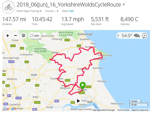
View the day’s ride on the Yorkshire Wolds Cycle Route in Garmin Connect.